

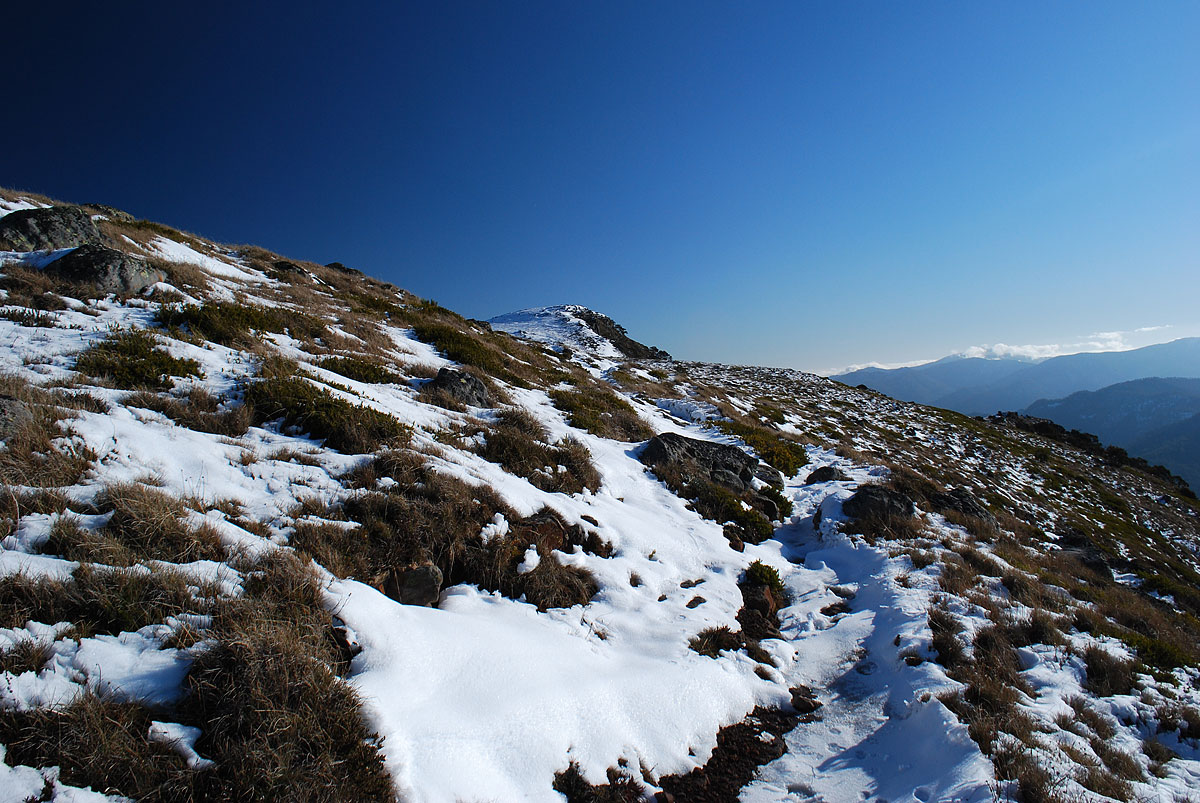

This four day hike is a circuit that starts at the Mount Howitt Car Park in Victoria's Alpine National Park. It then goes down the Dry River Track to the Wonnangatta Valley and then to the top of The Viking. From there passes over The Razor, Mt Despair, Mt Speculation, Mt Buggery and the The Crosscut Saw. With a short side trip to Mt Howitt and then on to Macalister Springs. The hike then concludes with the return to Howitt Car Park. The entire trip takes four days but there are interesting places to see if you have more time. Included are some interesting variations to South Viking and also The Terrible Hollow and along the Wonnangatta River. There is also a description of a short cut (although I can't recommend it) to South Viking along the ridge in between the Wonnangatta River and Riley Creek.
Bushfires, floods and man made changes can change the terrain described in this article drastically. This article is a guide only. Make sure you have the latest map and a compass or GPS. You should also have a Personal Locator Beacon and equipment adequate for a hike in the wilderness. Make sure you are prepared for snow which can happen on the range at any time of the year.
The map used in this article was: SVmaps "Buller - Howitt Alpine Area". 2nd Edition. 1:50 000. This guide was written in 2014. Amended 2016. Amended 2020.
You need to know how to read a map and use a compass or GPS. Parts of the track are difficult to follow and slow to travel through. Some of the short cuts I describe are off track or on very degraded and rarely used tracks.
The trip to Howitt Car Park along Howitt Road can be done with a two wheel drive car. Although you may want to take it slow in the spring as the snow melt can leave a few pot holes behind. It depends on how good the road is and what kind of car you have but it normally takes about four or five hours to get there from Melbourne.
If you wish you can do this hike going the other way around but that means the last day is a boring slog up Dry River Track or Zeka Track. Doing it this way means the best part of the hike is on the last day! There is an in intentions book and a pit toilet at the car park. Fill out the intentions book with your car rego, names, route and the date and remember to sign out when you return. BUT ALWAYS LEAVE YOUR DETAILS WITH SOMEONE AT HOME. These intentions books are only checked if you are reported missing. Also fill out any logbooks along the way so searchers know where you got to before you were eaten by tigers.
To make it easier for your self, leave the packs at the beginning of the Dry River Track as you drive by to Howitt Car Park. You pass it on the road to the car park and it is sign posted. Walk back down Howitt Road to the beginning of Dry River Track, shoulder your packs and follow the foot track down to Dry River and the Wonnangatta River. The track is fairly easy to follow and there are occasional orange track markers along the way as well. The only hard bit is when you reach Dry River. When the track rinally reaches the valley it crosses a tiny tributary creek that feeds into Dry River. Cross that and you will quickly come to Dry River itself. Corss the river as the track is on the other side. As of 2020, there is a bit of a tangle of tree trunks. But all you have to do is to head down stream - following the fairly distinct foot track. If you are coming the other way you will find picking the right spur a chore as the scrub makes the terrain difficult to make out. Follow the foot track until it crosses Dry River. There is an elaborate camp site on the other side where someone has built camp furniture and a large frame for a tarp shelter. The rest of the trip is along a four wheel drive track. Despite what the map says, the track continues along Dry River all the way to Wonnangatta Track (which is a proper unsealed road). There are plenty of camp sites along Dry River and the Wonnangatta River as well. My favourite one is at the ford across the Wonnangatta, just where Wonnangatta Road crosses over the ridge to Riley Creek. But there is almost always four wheel drivers there. It is big enough to share - or there is a little camp site a few metres before you get there. I would normally camp somewhere in the valley on the first night. Although crossing over the ridge line and camping along Riley Creek does shave an hour off the next days hike - but the camp sites are not nearly as pretty.
If you have time (or want to add an extra day to the hike) you might want to head down to the Wonnangatta Station Ruins (there is also a hut there). The Bryce family cemetery is on the way and the station is the site of a very famous (and grisly) double murder that happened in 1917. The murders were never solved. It's a lovely place with incongruous European trees and plants that (to me, anyway) gives the place an other worldly aspect.
If you do not want to use the Dry River Track there is another way down to Wonnangatta. Just walk down Zeka Track. This is a proper unsealed road and it is easy but boring. It also wanders around a bit so it is longer. If you decide to take Zeka Track then there is a short cut - a foot track that bypasses the first part of Zeka Track. This foot track is Old Zeka Track. From Howitt Car Park just follow the foot track to Mt Howitt and Macalister Springs. About two thirds of the way to the springs you will see a the sign post to this track (not the first sign post, but the one that actually says "Old Zeka Track"). This track is a faded in places but easy to follow as it just heads down the obvious spur until it meets up with the new Zeka Track. Coming the other way, Old Zeka Track is obscured by a little cliff and a bank of earth used to close down the track. You will find it where Zeka Track does a sharp left turn and first begins to follow the side of the hillside - instead of zig zaging directly up the spur.
The next stage is to take Wonnangatta Track over the Blue Hills ridge line (the ridge between the Wonnangatta River and Riley Creek) to Riley Creek. There are some rough camp sites along Riley Creek. From the cross road at Wonnangatta Track and Rileys Track, just take the old, disused track that goes straight ahead - down to and then along the creek until you find a campsite you like. There is also a camp site at the bridge that crosses Riley Creek.
As you cross over the ridge to Riley Creek (and look at the map), it might occur to you that the ridge line seems to be a quick and easy shortcut to South Viking and then to The Viking itself. Although there is not and never has been, a track. This has certainly occurred to me in the past and in the Autumn of 2014 I decided to give it a go. It had rained heavily the day and night before but the temperature was surprisingly mild and although it was cloudy the sun was making an occasional appearance. "So what the hell" I thought to myself. The ridge itself proved relatively easy to follow but the cloudline moved down below me. The drizzle began an hour after I started and mild scrub eventually turned into thick scrub which then turned into rain jungle which was mixed in with large patches of impassible dead fall from fire ravaged trees. And that's when it really started to bucket down. I suspect this route might have once been fairly easy. But like so many areas in Victoria, the freakishly intense and widespread bushfires of recent years have done their work. First the bushfire burns everything down to bedrock. The ash acts as a fertiliser and the normally shady forest floor gets virtually uninterrupted sun. Then the winter brings plenty of rain and snow and as a result of all of this the forest floor gets a dense, explosive growth of scrub. This always seems to be at head height and makes walking and navigation very difficult. The only easy bit I had for this little adventure was where the ridge joined the back end of South Viking. There must have been a fire through that summer and it had burned out an area of scrub (but of course that means it will be even denser scrub in a year or two). I'm glad I had an explore but I wouldn't bother doing it again and I wouldn't recommend it either. It's about half the distance of the normal way but about the same time. If you ever decide to do it, there is a cairn on South Viking and a series of small cairns that lead to The Viking's summit.
From the bridge, continue along the road north. The four wheel drive track climbs up to the hills and meets up with Van Dammes Track which then connects to The Alpine Track. It will still get you to Barry Saddle but it is much longer. I recommend taking the old Wonnangatta Track which is still quite easy to follow (but it's not marked on recent maps). To find it; just keep walking along the road after the bridge that crosses Riley Creek. The creek valley is quite scrubby and thick with dead fall. After ten or fifteen minutes it leaves Riley Creek and follows the usually dry and un-named tributary that joins Riley Creek from the north. The road climbs up the side of the road for a while and then comes back down again. Then it starts climbing again and the valley is narrow enough that you can see the other side of the valley (but you can't see the old road on the other side because of growth along its edges). You will be a few metres above the creek bottom when you should see a mound of grass covered dirt on the left that was used to block off the entrance to the road and there is a suspiciously road like, grassy meadow which is flanked by saplings, on the creek bottom below the road that heads across to the other side of the little valley (you may also see a little pad behind the mound made by hikers using this route). The grid reference is roughly 816 903. Follow the grassy meadow across to the opposite slope. You will have to climb over and under some large fallen trees and cross the (usually dry) little tributary. A few metres after that, as you start to climb the opposite slope, you will see the road cutting. It curves around the side of the valley heading south, eventually curving around to the sharp and obvious spur. It then follows the spur heading north and up. Apart from a few bushes and occasional dead fall it is easy going. Only at the very top has some thick scrub formed on the track. At the very top it follows the curve of the hill and comes out just under and a little south west of the 1134m hill at the top of the spur. Coming the other way, this track can plainly be seen on the left hand side of the disused four wheel drive track that Alpine Track follows. There is even an Alpine Track marker where they join so that people know which way to go.
When you get to the top, turn left where the tracks meet. There is a camp site at Barry Saddle and a water tank and an intentions book. Keep in mind that the tank is not as certain as a creek. There is always the possibility that the tank has been destroyed by bush fire, or has been damaged or run dry. So have a little bit of water with you just in case. From Barry Saddle you just need to walk west along the ridge that eventually becomes The Viking. It's an easy walk along a sharp and fairly open ridge. There are some fine views once the track heads up steeply to the top of The Viking. Once you get to the top of the ridge the route winds around, along or over the rocky crags of The Viking. There is a lovely camp site at the top - just before you get to the summit.
Keep going to the summit and then follow the Alpine Track markers as the track runs below and along the north side of the summit. Keep your eyes open for the track marker pointing the way down the correct gully. This gully descends through the precipitous cliffs of The Viking to Viking Saddle. The way down is steep but not too bad except for one choke point - a steep narrow gully filled with very large boulders and cliffs and dead fall. Some people (especially if it is wet) may like to drop their packs down on a line before descending. Both sides of the way down to Viking Saddle were badly affected by the bush fires of the past few years and regrowth of scrub has been explosive. But the track has since been recut and is easy to follow now.
Viking Saddle is a roomy meadow with good views of the towering cliffs of The Viking and plenty of places for a tent. I would normally camp here on the second night. There is water to be found on both sides of the saddle. But I usually have the most luck with the north side. Sometimes you only need to travel a few minutes before you find water. Just follow the little pad/track you can see on the grassy, right hand hill side. Eventually it descends to the creek line and you might find water straight away. But usually you follow it down to the little waterfall and there - you should find a couple of little pools at the top of the waterfall. But sometimes it can be a major expedition because you will have to climb down the waterfall and keep going. On at least one occasion I found no water at all on either side. Luckily I had a litre of water spare - but it was a thirsty night.
Next day, head up from the saddle to The Razor. The Razor (strictly speaking, it is the ridge that connects The Razor proper with Mount Despair. If you have time, drop your packs and make the short trip to the Razor itself) is only a short section of the days walk but used to be remarkably time consuming. More track markers and cairns have been set up along this section nowadays. So it is pretty easy compared to the old days. The Alpine Track does zig zags up and down the steeply sloping southern side of The Razor. The great sheets of sloping rock face are riven by deep unclimbable gorges. At the same time the bottom of the rock faces are a jumble of great and small rocks with incredibly dense thickets of snow gum and scrub. Sometimes the only way through is to climb up high and sometimes to go down low. Do your best to follow the track markers and don't be deceived by what looks like the obvious and easy routes. Above all, be willing to back track to reacquire the track. Sore legs are better than a broken spine. The only serious injury I have ever had in decades of hiking happened to me here. I had to finish the last two days of this exact hike on a dislocated knee.
Eventually you will come to a small saddle and the trip becomes easy. If you need a camp site, keep going for a little bit. To where the Alpine Track leaves the ridge and starts to climb to the top of Mount Despair, there is a little camp site beside the track (the very short track to it is very obvious) with an absolutely magnificent view of The Razor. The way up to Mount Despair and down to Catherine Saddle (or Catherine Pass, as it is also known) is a doddle. There is a small cairn on the summit but no view. Just a broad hill top covered in snow gums. Catherine Saddle becomes more overgrown every year but there is a grassy camp site there with a cement ring fireplace and an Alpine track marker on a post. If you have an explore around the saddle you will find an old dug out fire shelter behind the camp site.
You will also notice that on the South side of the camp site there is a foot track/old 4WD track that joins up with The Alpine Track. This is an interesting (but very rugged) route across The Terrible Hollow. It is an old four wheel track that is cut into the side of the range that eventually ends up at the Wonnanagatta River. See the article below for a description. If you walk down this track for 10 or 15 minutes you will see thickly clustered ferns beside the track and on the side of the hill. There is often (but not always) water under these ferns from a seep on the hillside. From Catherine Pass, continue along the Alpine Track as it follows the old disused four wheel drive track to Camp Creek. You can follow this track to Camp Creek and from there take the path up to Speculation Saddle. But there is a short cut that heads straight up the ridge to Speculation Saddle. It is marked by a cairn on the track (don't be decieved by deer tracks that look man made). It is a steep scramble at the bottom but much quicker. If you decide to stay on the four wheel drive track then you will eventually reach a steel gate. On your left you will see the path up to Speculation Saddle and a few metres ahead you will see Camp Creek - which is sign posted. The water has been contaminated by idiots camping at Speculation Saddle who have shat in the catchment of the creek and needs to be boiled. I have drunk the water in late winter/early spring when it is flushed by snow melt but I would advise caution even then. Please shit under the cliffs on the south side of the Speculation Saddle camp site. Make sure you dig a hole and completely bury everything. If it isn't deep and air tight the flies get into it. The same flies buzzing around your head and landing on your face.
Speculation Saddle is a magnificent camp site perched on high cliffs with an outstanding view of the way you have come and the way you will go. I would normally spend the third night here. But you will have plenty of time in hand if you want to keep going. You can camp on Mount Speculation (but it's very exposed), or Mount Buggery. Which has a broad comfortable camp site somewhat sheltered by snow gums (but no water but what you carry in). You could even keep going to Macalister Springs if you are really gung ho. The section of the walk after Speculation Saddle is the loveliest hike in the national park. It can be very exposed in bad weather with knife edged ridge tops in places. The walk is a series of ups and downs but the only real slog is up to the top of Mount Buggery. There are a couple of little easy cliffs here and there but nothing to worry about. The only time you should be wary is in the winter. Snow forms false crests and dangerous overhangs that can give way under you. And bad weather in winter can be very bad indeed.
At the end of the Cross Cut Saw the Alpine Track turns right (west) and heads to the top of Mount Howitt. You will need to turn left and head east towards Macalister Springs. However, if you have time, it's worthwhile dumping the packs and taking the short and easy foot track to the top of Mount Howitt. Howitt is really just a little hill on top of a broad rolling alpine meadow. But at 1742 metres it is the highest peak of the entire trip.
Macalister Springs is a lovely spot with plenty of camp sites and water. The camp sites around the hut are fuel stove only. It is also the location of Vallejo Gantner Hut. This is the loveliest hut in the Alpine National Park. But unless you go there when it's under two metres of snow - you are very unlikely to be able to sleep in it as it is very popular and crowded. Also if you get a chance, use the pit toilet. It is a very modernist interpretation of a "bush dunny" and is perched above the steep hillside behind the hut and the wall facing outwards is perspex! It brings new meaning to the phrase "communing with nature." The walk back to the car park from here is easy and travels through soft, green grass meadows and thickets of snow gum. Make sure you remember to sign out at the intentions book at the car park.
Here are two interesting (and rugged) variations from the route I have described above.
I would advise doing these treks only in good weather and you need to be confident and skilled with map and compass. Be prepared for major bush bashing and don't think of them as short cuts.
The first deviation starts at The Viking and then rejoins the route I have described at Catherine Saddle. This detour takes you down to The Terrible Hollow and the Wonnangatta River via South Viking.
The second deviation is to simply walk up the Wonanngatta River to Catherine Saddle. In other words, to bypass Riley Creek, The Viking and Mt Despair entirely. You will find this trip is actually marked on the "Buller - Howitt Alpine Area" map that I have used for this guide as a foot track. But in reality there really is no formed track. Just the remains of the old four wheel drive track here and there, deer pads and trackless bush.
The first side trip: The Viking to Catherine Pass.
This trip descends down the ridge on the other side of South Viking to the Wonnangatta River and then heads upstream - taking the old four wheel drive track that eventually joins the Alpine Track at Catherine Saddle.
From the top of The Viking follow the Alpine Track markers as the track runs below and along the north side of the summit. When you get to the marker that indicates the route down to Viking Saddle; ignore it and keep going straight ahead. You will come to a broad saddle on your left. Climb up to this saddle and head south over to the broad hill ahead. Turn south east and cross the next saddle and climb South Viking on the other side. There are plenty of camp sites on these saddles but no water that I know of. Alternatively, There is a cairned route from the summit of The Viking that takes you over the tops to the South Viking Summit (which has a cairn on it). From the top of South Viking head along the long spur that first heads south west and then turns dead south (and has magnificent cliffs on it's western edge). The spur and the cliffs are clearly visible from South Viking and the way is very obvious and pretty easy. As you head south along the spur you will see that there is a little valley below with a low ridge on it's southern side and then another valley on the other side of that ridge. The second valley is the Wonnangatta River. You have a very good view for most of the way down. So just steer for where that little ridge is lowest. The first little valley is very pretty and fairly easy and open. The ridge is a short climb up but is very steep (but short) on the other side as it descends to the banks of the Wonnangatta River. From the river, turn left to link up with Zeka Track or right to go to Catherine Saddle. Below is detailed instructions about the trip along the Wonnangatta River.
The second side trip: along the Wonnangatta River.
To go directly to Catherine Saddle from the Wonnangatta River; following the river upstream and then an old four wheel drive track cut into the side of Mt Despair. But, just to confuse you, I have actually started this description the other way around because last time I did it (2014) I actually started at Catherine Saddle and made my way down to the river.
At Catherine Saddle you can clearly see the old four wheel drive track that heads south down the valley and crosses The Terrible Hollow and eventually descends down to the Wonnangatta River. At one time this was a four wheel track that joined up with Zeka Track but although it is marked on the map as a foot track - most of it has been obliterated by time and bushfire. You need to be very confident of your navigation and bush bashing skills to do this trip. From Catherine Saddle head down the track as it zig zags down the slope. It then straightens out and because it is cut into the side of the range as it heads south east, it is easy to follow. As an added bonus someone, probably the park rangers, have chainsawed some of the dead fall away sometime in the past few years (although there has been some dead fall since then). Even better, some of the scrub on the track has been roughly cut back. So the first bit is quite easy. But all good things come to an end. The track eventually does a little zig zag down hill (which is not marked on the map - although old maps I have show it) and the track becomes very, very overgrown and covered in dead fall. Because the slope is less pronounced at this point, the track can be hard to make out here. Keep your eyes peeled for where the road was cut into the side of the hill. This point is near where the old track reached the ridge/spur and started to head south along the top of that spur. But the spur is quite broad and covered in thick, post bushfire scrub. So you will see few signs of the old road. Eventually the spur becomes obvious and there are even occasional little clearings. You'll come to a little saddle and then the spur broadens again. Keep on the eastern side of it (the slope downhill - on your left is steep and obvious) but you need to be careful to follow this last little plateau around as the track does a right turn and goes west down a little spur until it hits the river. When you get to the river you can still make out the cutting in both sides of the river bank where the track forded the river. There is also a cairn on the north side of the river bank (unless it has been swept away by floods). There is a rough little camp site on the south side of the crossing.
Don't panic if you do lose the track. The Wonnangatta River is always down slope on your right hand side. If you have to, just bush bash down to the river and follow it downstream. From the camp site at the ford, follow the rough pad as it follows the river downstream. Occasionally it is easy to see where the old four wheel track once was but a lot of the "track" is just where the pestilential deer have taken the easiest way and kept the path open - sort of. The problem is that sometimes the deer have been diverted by dead fall or just decided to take a different way that can then just disappear. In muddy patches you can see from the hoof prints just how many of these invasive pests infest the area. As a rough guide, the track mostly doesn't stick too closely to the river. The terrain is more open the further back you are from the river. There is even an occasional meadow to camp in if you need it. But at the end of the day you can't get lost. Just follow the river downstream. A round about two thirds of the way downstream the valley narrows and the track occasionally crosses the river from side to side. Unless the river is in flood it is easy to skip across on rocks. You can usually tell when the track does this as it is avoiding steep hillsides or cliffs ahead.
The important point to look out for is where the river does a very sharp turn and heads north. Be on the west side of the river and follow the track which goes a little back from the river. Unfortunately, there are thick tangles of blackberries along the river here so it's best to be on the track. You need to follow the river as it heads north for a few hundred metres. The track will then head towards the river and the old four wheel drive crossing and you will see a rough camp site beside the river. On the other side you can see the cutting for the ford and the old four wheel drive track. There was also some coloured tape tied around a tree trunk last time I was there. Once you cross and head up the slope the way is pretty obvious as the track after this is not very overgrown. The track climbs up for a little bit, goes into a little gully and then continues up to join up with Zeka Track. Four wheel drivers have obviously done some exploring up at the top. So if you are coming the other way, the turn off from Zeka Track is very obvious and there are also camp sites at the junction.